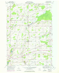
1950 Map of Byron
USGS Topo · Published 1978About this map
Black Creek winds through a landscape of drumlins and wetlands in this mid-century Genesee County survey, characterized by the expansive Byron Bergen Swamp Wildlife Sanctuary. The settlement pattern follows the railroad and early thoroughfares, with Byron and South Byron serving as central hubs connected by the Conrail line and an Old Railroad Grade. To the south, Morganville sits near the banks of Bigelow Creek, while the northeast corner is anchored by North Bergen.
Find a feature on this map
44 named features on this map. Tap any name to fly to it.
Don’t see what you’re looking for? This feature index may not catch every label — zoom into the map to look around manually.
Map Details
Editions of this 1950 Byron Map
Other maps of this area

1897 · Albion
USGS Topo · 1:62,500

1899 · Brockport
USGS Topo · 1:62,500

1904 · Batavia
USGS Topo · 1:62,500

1904 · Caledonia
USGS Topo · 1:62,500

1934 · Brockport
USGS Topo · 1:24,000

1935 · Churchville
USGS Topo · 1:24,000

1944 · Churchville
USGS Topo · 1:31,680

1944 · Holley
USGS Topo · 1:31,680

1944 · Byron
USGS Topo · 1:31,680

1944 · Stafford
USGS Topo · 1:31,680