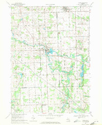
1969 Map of Byron
USGS Topo · Published 1971About this map
Byron and Gaines serve as the primary hubs in this late 1960s survey of the Shiawassee River valley. The landscape is defined by the winding course of the Shiawassee River and the South Branch Shiawassee River, which feed into the central Byron Millpond. In the southern reaches, the Oak Grove State Game Area preserves a significant portion of the river's wetlands and woodlands near Cohoctah.
Find a feature on this map
53 named features on this map. Tap any name to fly to it.
Don’t see what you’re looking for? This feature index may not catch every label — zoom into the map to look around manually.
Map Details
Editions of this 1969 Byron Map
3 editions found
Other maps of this area

1907 · Howell
USGS Topo · 1:62,500

1908 · Fowlerville
USGS Topo · 1:62,500

1909 · Howell
USGS Topo · 1:62,500

1910 · Fowlerville
USGS Topo · 1:62,500

1922 · Durand
USGS Topo · 1:62,500

1926 · Corunna
USGS Topo · 1:62,500

1929 · Corunna
USGS Topo · 1:62,500

1943 · Durand
USGS Topo · 1:62,500

1944 · Corunna
USGS Topo · 1:62,500

1954 · Detroit
USGS Topo · 1:250,000