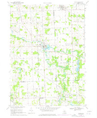
1969 Map of Byron
USGS Topo · Published 1976About this map
Byron serves as the central hub of this late-1960s landscape, situated where the Shiawassee River broadens into the Byron Millpond. The settlement pattern reflects a deeply established agricultural and river-based economy, with the village grid tightly clustered near the water. To the north, the village of Gaines marks a distinct rail-oriented settlement, while Cohoctah anchors the southern portion of the survey. The geography is defined by the winding course of the South Branch Shiawassee River, which meanders through the marshy lowlands and provides a natural corridor between the Shiawassee, Genesee, and Livingston county lines. This 1969 field-checked survey, later updated with 1975 photogrammetric revisions, captures the transition of the mid-Michigan countryside as small rural centers remained relatively isolated before significant modern expansion.
Find a feature on this map
6 named features on this map. Tap any name to fly to it.
Don’t see what you’re looking for? This feature index may not catch every label — zoom into the map to look around manually.
Map Details
Editions of this 1969 Byron Map
3 editions found
Other maps of this area

1907 · Howell
USGS Topo · 1:62,500

1908 · Fowlerville
USGS Topo · 1:62,500

1909 · Howell
USGS Topo · 1:62,500

1910 · Fowlerville
USGS Topo · 1:62,500

1922 · Durand
USGS Topo · 1:62,500

1926 · Corunna
USGS Topo · 1:62,500

1929 · Corunna
USGS Topo · 1:62,500

1943 · Durand
USGS Topo · 1:62,500

1944 · Corunna
USGS Topo · 1:62,500

1954 · Detroit
USGS Topo · 1:250,000