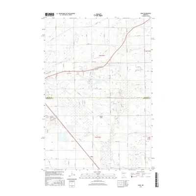
2016 Map of Cable
USGS Topo · Published 2016About this map
The settlement of Cable serves as a central landmark in this 2016 survey of the area southeast of St. Cloud, where the Benton Co Sherburne Co line divides the landscape. The terrain is defined by a dense network of wetlands and drainage features, including County Ditch Number Five and the winding course of the Elk River and Mayhew Cr. Genealogists and local historians will find significant sites such as Saint Patrick's Cem and the Minnesota Reformatory Cem, the latter situated near the Jail Trail. The presence of the St Cloud Regional Airport dominates the central portion of the map, illustrating the intersection of modern infrastructure with the rural township grids of Minden Twp 9 and Minden Twp 8. Residential growth is evident along corridors like Wapicada Rd and Shadowwood Dr NE as the region transitions from agricultural use.
Find a feature on this map
46 named features on this map. Tap any name to fly to it.
Don’t see what you’re looking for? This feature index may not catch every label — zoom into the map to look around manually.
Map Details
Editions of this 2016 Cable Map
This is the sole edition of this map. No revisions or reprints were ever made.
Other maps of this area

1950 · St. Cloud
USGS Topo · 1:62,500

1951 · Annandale
USGS Topo · 1:62,500

1953 · Saint Cloud
USGS Topo · 1:250,000

1953 · Stillwater
USGS Topo · 1:250,000

1955 · Stillwater
USGS Topo · 1:250,000

1957 · Saint Cloud
USGS Topo · 1:250,000

1958 · Stillwater
USGS Topo · 1:250,000

1958 · Saint Cloud
USGS Topo · 1:250,000

1961 · Clear Lake
USGS Topo · 1:24,000

1961 · Monticello
USGS Topo · 1:62,500