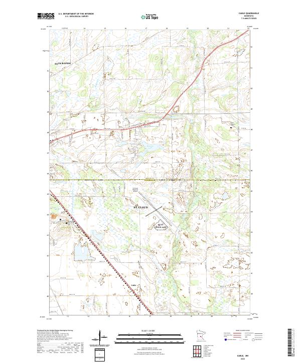
2022 Map of Cable
USGS Topo · Published 2022About this map
The St. Cloud metropolitan area and the smaller settlement of Cable are the focus of this modern survey of the landscape southeast of Sauk Rapids. A significant portion of the sheet is occupied by the St Cloud Regional Airport, illustrating the transport infrastructure that defines this portion of the Benton and Sherburne county line. For those researching institutional history or genealogy, the Minnesota Reformatory Cem near Minnesota Blvd and the Saint Patrick's Cem to the northeast provide vital links to the region's past inhabitants.
Find a feature on this map
46 named features on this map. Tap any name to fly to it.
Don’t see what you’re looking for? This feature index may not catch every label — zoom into the map to look around manually.
Map Details
Editions of this 2022 Cable Map
This is the sole edition of this map. No revisions or reprints were ever made.
Other maps of this area

1950 · St. Cloud
USGS Topo · 1:62,500

1951 · Annandale
USGS Topo · 1:62,500

1953 · Saint Cloud
USGS Topo · 1:250,000

1953 · Stillwater
USGS Topo · 1:250,000

1955 · Stillwater
USGS Topo · 1:250,000

1957 · Saint Cloud
USGS Topo · 1:250,000

1958 · Stillwater
USGS Topo · 1:250,000

1958 · Saint Cloud
USGS Topo · 1:250,000

1961 · Clear Lake
USGS Topo · 1:24,000

1961 · Monticello
USGS Topo · 1:62,500