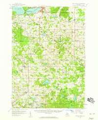
1957 Map of Cadillac South
USGS Topo · Published 1959About this map
Lake Cadillac and Lake Mitchell define the northern boundary of this central Michigan landscape, where the southern reaches of the city meet the expansive woodlands of Fife Lake State Forest and Houghton Lake State Forest. The mid-century rural infrastructure is meticulously documented, showing a transition from active timber and agricultural life to early industrial development, evidenced by the Mineral Spring Oil Field and the broadcast presence of Radio Tower (WWTV).
Find a feature on this map
127 named features on this map. Tap any name to fly to it.
Don’t see what you’re looking for? This feature index may not catch every label — zoom into the map to look around manually.
Map Details
Editions of this 1957 Cadillac South Map
3 editions found
Other maps of this area

1931 · Chase NE
USGS Topo · 1:31,680

1933 · Luther SE
USGS Topo · 1:31,680

1954 · Traverse City
USGS Topo · 1:250,000

1954 · Midland
USGS Topo · 1:250,000

1956 · Mesick
USGS Topo · 1:62,500

1956 · Cadillac North
USGS Topo · 1:62,500

1956 · Lake City
USGS Topo · 1:62,500

1957 · Cadillac South
USGS Topo · 1:62,500

1957 · Luther
USGS Topo · 1:62,500

1957 · Marion
USGS Topo · 1:62,500