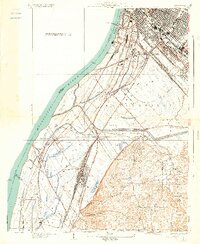
1934 Map of Cahokia
USGS Topo · Published 1934About this map
Industrial hubs and transit corridors define this 1930s landscape across the American Bottoms of St. Clair County. The Mississippi River forms a dominant western border, shaping the rail-heavy developments at Monsanto and the massive rail yards of the Missouri Pacific Railroad near Dupo. This era shows a complex network of steel and electricity, including the St Louis and Waterloo Electric Railroad and the St Louis Belleville and Electric Railroad, reflecting the dense commercial connectivity between Illinois and St. Louis.
Find a feature on this map
64 named features on this map. Tap any name to fly to it.
Don’t see what you’re looking for? This feature index may not catch every label — zoom into the map to look around manually.
Map Details
Editions of this 1934 Cahokia Map
2 editions found

Other maps of this area

1888 · St. Louis
USGS Topo · 1:62,500

1910 · Waterloo
USGS Topo · 1:62,500

1912 · Kimmswick
USGS Topo · 1:62,500

1913 · Waterloo
USGS Topo · 1:62,500

1916 · Kimmswick
USGS Topo · 1:62,500

1931 · French Village
USGS Topo · 1:24,000

1933 · Granite City
USGS Topo · 1:24,000

1933 · Jefferson Barracks
USGS Topo · 1:24,000

1933 · Cahokia
USGS Topo · 1:24,000

1933 · Clayton
USGS Topo · 1:24,000