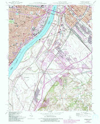
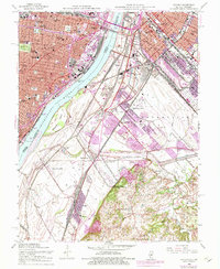
1954 Map of Cahokia
USGS Topo · Published 1993About this map
The Mississippi River serves as the central artery for this industrial and urban corridor, separating the dense street grids of St Louis from the Illinois settlements of East St Louis and Cahokia. Industrial development and aviation history are prominent, with the Bi-State Parks Airport and the specialized infrastructure at Fox Terminal and Vulcan illustrating the mid-century economy. The Illinois side shows a mix of older community centers like Falling Spring and Stolle alongside growing suburban developments in Centreville and Alorton. Educational and religious institutions are particularly dense on the Missouri side, featuring the Missouri School for Blind, Loretto Academy, and McKinley High Sch. Southward, the landscape shifts toward drainage systems and smaller lakes such as Schmids Lake and Triple Lakes, where the rail lines of the St Louis City St Clair Co network crisscross the lowland plains near Dupo and North Dupo.
Find a feature on this map
71 named features on this map. Tap any name to fly to it.
Don’t see what you’re looking for? This feature index may not catch every label — zoom into the map to look around manually.
Map Details
Editions of this 1954 Cahokia Map
5 editions found
Other maps of this area

1888 · St. Louis
USGS Topo · 1:62,500

1910 · Waterloo
USGS Topo · 1:62,500

1912 · Kimmswick
USGS Topo · 1:62,500

1913 · Waterloo
USGS Topo · 1:62,500

1916 · Kimmswick
USGS Topo · 1:62,500

1931 · French Village
USGS Topo · 1:24,000

1933 · Granite City
USGS Topo · 1:24,000

1933 · Jefferson Barracks
USGS Topo · 1:24,000

1933 · Cahokia
USGS Topo · 1:24,000

1933 · Clayton
USGS Topo · 1:24,000