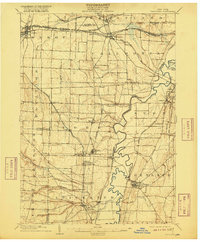
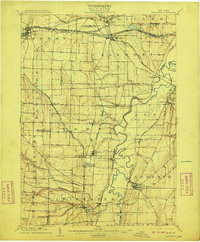
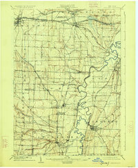
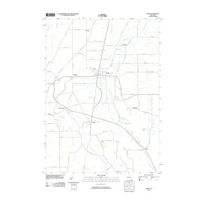
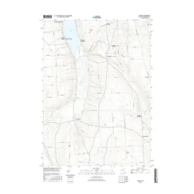
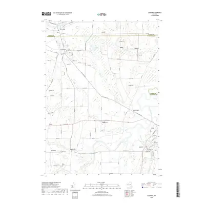
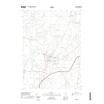
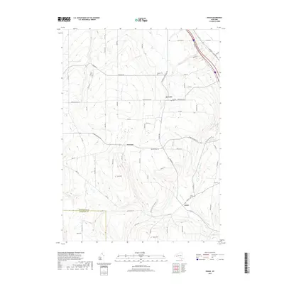
1904 Map of Caledonia
USGS Topo · Published 1916About this map
The Genesee River meanders through the heart of this early twentieth-century landscape, carving a wide valley floor marked by dramatic oxbows and riparian wetlands. The region is a dense intersection of historical transit, where numerous rail lines like the Delaware Lackawanna and Western R. R. and the Lehigh Valley cross the terrain to serve agricultural and industrial hubs. Significant local centers include Caledonia and Geneseo, the latter showing a concentrated street grid overlooking the river valley. The map documents smaller rural points of interest such as Retsof, Fowlerville, and Greigsville, alongside essential post offices like Wadsworth P.O. and Moscow P.O. Leicester. Smaller waterways like Oatka Creek in the north and Beards Creek in the south define the drainage patterns of the surrounding townships, including Wheatland and York, during a period of high rail activity and established settlement.
Find a feature on this map
59 named features on this map. Tap any name to fly to it.
Don’t see what you’re looking for? This feature index may not catch every label — zoom into the map to look around manually.
Map Details
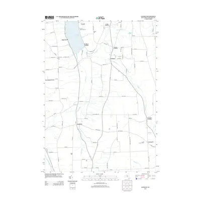
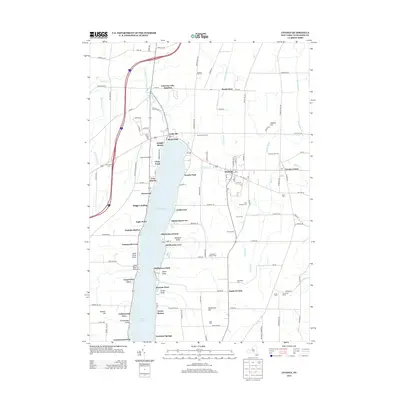
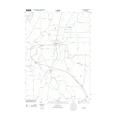
Editions of this 1904 Caledonia Map
6 editions found


Historical Maps of Geneseo Through Time
81 maps found

1902 Wayland
Livingston County, NY

1904 Caledonia
Livingston County, NY

1904 Wayland
Livingston County, NY

1905 Nunda
Livingston County, NY

1934 Rush
Livingston County, NY

1942 Conesus
Livingston County, NY

1942 Livonia
Livingston County, NY

1943 Mount Morris
Livingston County, NY

1943 Nunda
Livingston County, NY

1943 Ossian
Livingston County, NY

1943 Sonyea
Livingston County, NY

1944 Geneseo
Livingston County, NY

1944 Leicester
Livingston County, NY

1944 Mount Morris
Livingston County, NY

1944 Nunda
Livingston County, NY

1944 Ossian
Livingston County, NY

1944 Sonyea
Livingston County, NY

1950 Caledonia
Livingston County, NY

1950 Geneseo
Livingston County, NY

1951 Caledonia
Livingston County, NY

1951 Leicester
Livingston County, NY

1951 Livonia
Livingston County, NY

1951 Rush
Livingston County, NY

1957 Conesus
Livingston County, NY

1964 Conesus
Livingston County, NY

1971 Rush
Livingston County, NY

1972 Mount Morris
Livingston County, NY

1972 Nunda
Livingston County, NY

1972 Ossian
Livingston County, NY

1972 Sonyea
Livingston County, NY

1983 Canandaigua
Livingston County, NY

2010 Caledonia
Livingston County, NY

2010 Conesus
Livingston County, NY

2010 Geneseo
Livingston County, NY

2010 Leicester
Livingston County, NY
2010 Livonia
Livingston County, NY

2010 Mount Morris
Livingston County, NY
2010 Nunda
Livingston County, NY

2010 Ossian
Livingston County, NY

2010 Rush
Livingston County, NY

2010 Sonyea
Livingston County, NY

2013 Caledonia
Livingston County, NY
2013 Conesus
Livingston County, NY

2013 Geneseo
Livingston County, NY

2013 Leicester
Livingston County, NY
2013 Livonia
Livingston County, NY

2013 Mount Morris
Livingston County, NY
2013 Nunda
Livingston County, NY

2013 Ossian
Livingston County, NY

2013 Rush
Livingston County, NY

2013 Sonyea
Livingston County, NY

2016 Caledonia
Livingston County, NY
2016 Conesus
Livingston County, NY

2016 Geneseo
Livingston County, NY
2016 Leicester
Livingston County, NY
2016 Livonia
Livingston County, NY

2016 Mount Morris
Livingston County, NY
2016 Nunda
Livingston County, NY
2016 Ossian
Livingston County, NY
2016 Rush
Livingston County, NY

2016 Sonyea
Livingston County, NY
2019 Caledonia
Livingston County, NY
2019 Conesus
Livingston County, NY
2019 Geneseo
Livingston County, NY
2019 Leicester
Livingston County, NY
2019 Livonia
Livingston County, NY

2019 Mount Morris
Livingston County, NY
2019 Nunda
Livingston County, NY
2019 Ossian
Livingston County, NY
2019 Rush
Livingston County, NY

2019 Sonyea
Livingston County, NY

2023 Caledonia
Livingston County, NY

2023 Conesus
Livingston County, NY

2023 Geneseo
Livingston County, NY

2023 Leicester
Livingston County, NY

2023 Livonia
Livingston County, NY

2023 Mount Morris
Livingston County, NY

2023 Nunda
Livingston County, NY

2023 Ossian
Livingston County, NY

2023 Rush
Livingston County, NY

2023 Sonyea
Livingston County, NY