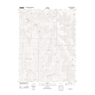
2013 Map of Calf Canyon
USGS Topo · Published 2013About this map
Kimball Mountain Rd traverses the high ridges of this Garfield County landscape, providing access through a complex network of drainage systems and high points. The terrain is defined by dramatic elevation changes, with prominent lookouts such as Calf Point and Barrel Spring Point overlooking deeply cut passages like Dark Canyon and Left Roberts Canyon. Water sources are critical landmarks in this arid environment, represented by Barrel Spring and the drainage of Barrel Spring Creek.
Find a feature on this map
35 named features on this map. Tap any name to fly to it.
Don’t see what you’re looking for? This feature index may not catch every label — zoom into the map to look around manually.
Map Details
Editions of this 2013 Calf Canyon Map
This is the sole edition of this map. No revisions or reprints were ever made.
Other maps of this area

1956 · Grand Junction
USGS Topo · 1:250,000

1959 · Grand Junction
USGS Topo · 1:250,000

1960 · Grand Junction
USGS Topo · 1:250,000

1962 · Grand Junction
USGS Topo · 1:250,000

1964 · Grand Junction
USGS Topo · 1:250,000

1964 · Douglas Pass
USGS Topo · 1:24,000

1964 · Brushy Point
USGS Topo · 1:24,000

1964 · Henderson Ridge
USGS Topo · 1:24,000

1964 · Calf Canyon
USGS Topo · 1:24,000
1964 · Razorback Ridge
USGS Topo · 1:24,000