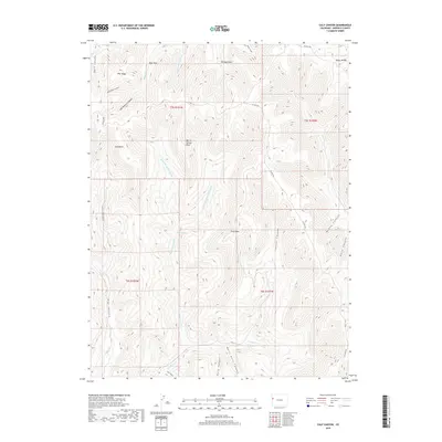
2019 Map of Calf Canyon
USGS Topo · Published 2019About this map
Pike Ridge and the high plateaus of Garfield County define this high-altitude landscape, where deep drainages like Hells Hole Canyon and Calf Canyon carve through the plateau. This 2019 survey documents a region defined by public land management and rugged topography, marked by prominent landmarks such as Upper 4A Mtn and Calf Point. The map reveals a complex network of seasonal water sources and canyons, including McKay Canyon and Buck Canyon, which feed into larger systems like E Salt Cr to the south. Co HWY 256 provides the primary transit corridor across the northern sections, connecting isolated open spaces like Bear Park and Williams Park. This modern topographic study is a detailed record of water security in an arid environment, highlighting vital points like Barrel Spring and the associated Barrel Spring Cr drainage system.
Find a feature on this map
33 named features on this map. Tap any name to fly to it.
Don’t see what you’re looking for? This feature index may not catch every label — zoom into the map to look around manually.
Map Details
Editions of this 2019 Calf Canyon Map
This is the sole edition of this map. No revisions or reprints were ever made.
Other maps of this area

1956 · Grand Junction
USGS Topo · 1:250,000

1959 · Grand Junction
USGS Topo · 1:250,000

1960 · Grand Junction
USGS Topo · 1:250,000

1962 · Grand Junction
USGS Topo · 1:250,000

1964 · Grand Junction
USGS Topo · 1:250,000

1964 · Douglas Pass
USGS Topo · 1:24,000

1964 · Brushy Point
USGS Topo · 1:24,000

1964 · Henderson Ridge
USGS Topo · 1:24,000

1964 · Calf Canyon
USGS Topo · 1:24,000
1964 · Razorback Ridge
USGS Topo · 1:24,000