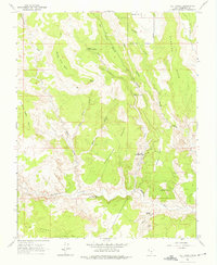
1964 Map of Calf Creek
USGS Topo · Published 1975About this map
Boulder Town sits at the northern edge of this high-plateau landscape, where the corporate boundary meets the rugged descent into Dry Hollow. This 1964 field-checked survey highlights the complex drainage system of Calf Creek, featuring both the Upper Calf Creek Falls and Lower Calf Creek Falls. The geography is defined by expansive plateaus like Durffey Mesa and Big Flat, separated by deep canyons and prominent benches such as New Home Bench and Haymaker Bench. Downstream, the Escalante River carves through the sandstone, revealing geological landmarks including the Escalante Natural Bridge and Maverick Bridge. Evidence of early habitation and natural wonders are noted throughout the canyons, from the Pictographs near the river to the towering Phipps Arch and Bowington Arch. The presence of the Calf Creek Recreation Area and its associated Campground indicates the mid-century development of this area for public access and conservation.
Find a feature on this map
32 named features on this map. Tap any name to fly to it.
Don’t see what you’re looking for? This feature index may not catch every label — zoom into the map to look around manually.
Map Details
Editions of this 1964 Calf Creek Map
5 editions found
Other maps of this area

1886 · Escalante
USGS Topo · 1:250,000

1953 · Circle Cliffs 2 NE
USGS Topo · 1:24,000

1956 · Escalante
USGS Topo · 1:250,000

1960 · Escalante
USGS Topo · 1:250,000

1964 · Tenmile Flat
USGS Topo · 1:24,000
1964 · King Bench
USGS Topo · 1:24,000

1964 · Dave Canyon
USGS Topo · 1:24,000
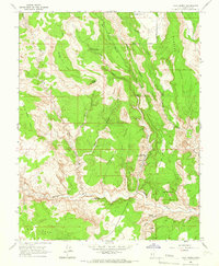
1964 · Calf Creek
USGS Topo · 1:24,000
1964 · Steep Creek Bench
USGS Topo · 1:24,000
1964 · Red Breaks
USGS Topo · 1:24,000