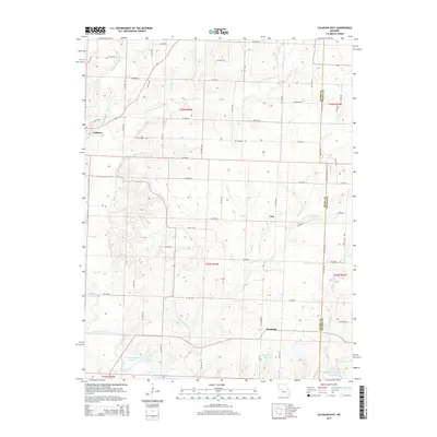
2015 Map of Calhoun East
USGS Topo · Published 2015About this map
The community of Calhoun and the eastern agricultural reaches of Henry County define this rural Missouri landscape. The terrain is deeply articulated by the Tebo Creek drainage system, including the Middle Fork Tebo Cr and E Fork Tebo Cr, which converge as they flow toward the southern extent of the map. Here, the landscape transitions into the fingers of the Harry S Truman Reservoir, a major hydrologic feature that has altered the local geography. Small settlements like Yolo and Roseland serve as focal points for the surrounding farmsteads connected by a dense grid of county roads.
Find a feature on this map
46 named features on this map. Tap any name to fly to it.
Don’t see what you’re looking for? This feature index may not catch every label — zoom into the map to look around manually.
Map Details
Editions of this 2015 Calhoun East Map
This is the sole edition of this map. No revisions or reprints were ever made.
Other maps of this area

1885 · Warrensburg
USGS Topo · 1:125,000

1887 · Clinton
USGS Topo · 1:125,000

1887 · Sedalia
USGS Topo · 1:125,000

1887 · Warsaw
USGS Topo · 1:125,000

1887 · Warrensburg
USGS Topo · 1:125,000

1894 · Warsaw
USGS Topo · 1:125,000

1894 · Sedalia
USGS Topo · 1:125,000

1894 · Warrensburg
USGS Topo · 1:125,000

1894 · Clinton
USGS Topo · 1:125,000

1936 · Shawnee Bend
USGS Topo · 1:24,000