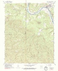
1964 Map of Calico Rock
USGS Topo · Published 1990About this map
White River navigation and the Missouri Pacific railroad define the economic landscape of this Ozark region. Centered on the town of Calico Rock, the survey captures a time when the river remained a vital corridor for the surrounding communities of Culp and Creswell. The terrain is characterized by a dense network of hollows, such as Schoolhouse Hollow and Livingston Hollow, which dictated the placement of early infrastructure like the Bethel Springs Sch and various family cemeteries including Katy Cem and Branscum Cem.
Find a feature on this map
79 named features on this map. Tap any name to fly to it.
Don’t see what you’re looking for? This feature index may not catch every label — zoom into the map to look around manually.
Map Details
Editions of this 1964 Calico Rock Map
4 editions found
Other maps of this area

1890 · Mountain Home
USGS Topo · 1:125,000

1891 · Mountain Home
USGS Topo · 1:125,000

1892 · Mountain View
USGS Topo · 1:125,000

1894 · Mountain View
USGS Topo · 1:125,000

1894 · Mountain Home
USGS Topo · 1:125,000

1945 · Harrison
USGS Topo · 1:250,000

1949 · Harrison
USGS Topo · 1:250,000

1954 · Harrison
USGS Topo · 1:250,000

1956 · Russellville
USGS Topo · 1:250,000

1958 · Harrison
USGS Topo · 1:250,000