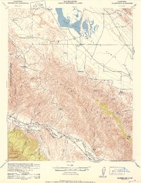
1942 Map of Caliente Mtn
USGS Topo · Published 1952About this map
Soda Lake dominates the northern alkali basin of this interior California landscape, serving as a stark focal point for the Carrizo Plain. Surrounding this terminal lake, a network of historic cattle operations such as Goodwin Ranch and Wellman Ranch suggests the area's mid-century reliance on seasonal grazing and groundwater. The topography transitions sharply into the Caliente Range, where steep canyons like Saltos Canyon and Morales Canyon drop toward the Cuyama River valley. This 1942 survey, later reprinted for civil use, documents a frontier-like geography where life centered on scattered water sources like Five Willow Spring and Turkey Camp Well. The southern reaches are defined by the Los Padres National Forest boundary and the high peak of Caliente Mtn, while the ancient geological landmark of Painted Rock stands as a notable cultural and navigational feature on the plain.
Find a feature on this map
42 named features on this map. Tap any name to fly to it.
Don’t see what you’re looking for? This feature index may not catch every label — zoom into the map to look around manually.
Map Details
Editions of this 1942 Caliente Mtn Map
2 editions found

Other maps of this area

1902 · Santa Ynez
USGS Topo · 1:125,000

1905 · Santa Ynez
USGS Topo · 1:125,000

1905 · Lompoc
USGS Topo · 1:125,000

1912 · McKittrick
USGS Topo · 1:125,000

1932 · La Panza
USGS Topo · 1:48,000

1935 · La Panza
USGS Topo · 1:62,500

1936 · La Panza
USGS Topo · 1:62,500

1937 · Branch Mtn
USGS Topo · 1:48,000

1941 · Caliente Mountain
USGS Topo · 1:62,500

1941 · McPherson Peak
USGS Topo · 1:62,500