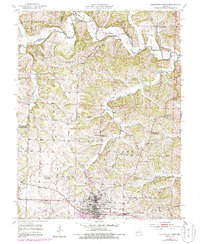
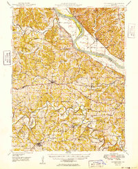
1952 Map of California North
USGS Topo · Published 1986About this map
The town of California serves as the focal point of this mid-century survey, situated at the junction of the Missouri Pacific railroad and the southern edge of the prairie-to-creek transition. The landscape is defined by the winding paths of North Moniteau Creek and South Moniteau Creek, where numerous small rural institutions once anchored the farming community. Genealogists will find a dense network of local landmarks, including several family burial sites such as Howard Cem and Boone Cem. The mid-1900s education system is well-represented, showing a transition toward consolidation as several neighborhood buildings like High Prairie Sch and Pleasant Ridge Sch were already marked as abandoned, while Aurora High School stands in the growing center of California. Distinctive rural spiritual centers like New Salem Ch and Old Salem Ch further illustrate the early settlement patterns of Moniteau County.
Find a feature on this map
30 named features on this map. Tap any name to fly to it.
Don’t see what you’re looking for? This feature index may not catch every label — zoom into the map to look around manually.
Map Details
Editions of this 1952 California North Map
4 editions found
Other maps of this area

1886 · Jefferson City
USGS Topo · 1:125,000

1888 · Boonville
USGS Topo · 1:125,000

1894 · Jefferson City
USGS Topo · 1:125,000

1947 · Jefferson City
USGS Topo · 1:250,000

1948 · Centertown
USGS Topo · 1:62,500

1948 · Columbia
USGS Topo · 1:62,500
1949 · Centertown
USGS Topo · 1:62,500

1950 · Columbia
USGS Topo · 1:62,500

1951 · California South
USGS Topo · 1:24,000

1951 · Latham
USGS Topo · 1:24,000