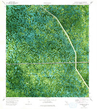
1974 Map of California Slough
USGS Topo · Published 1993About this map
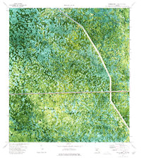
Big Cypress National Preserve occupies much of this Florida landscape, captured through orthophotography and planetable surveys in the early 1970s. The terrain is characterized by the intricate patterns of Doctors Prairie and the eponymous California Slough, showing the complex hydrology of the region before further modern development. Man-made interventions are starkly visible against the wetlands, specifically the Everglades Parkway (Toll Road) cutting east-to-west and the Levee 28 Interceptor Canal running along the eastern boundary. This boundary also serves as the divide between Collier and Broward counties, providing a clear look at how infrastructure was used to manage the swamp environment. A single Pipeline route further illustrates the mid-century industrial footprint within this protected ecological area.
Find a feature on this map
8 named features on this map. Tap any name to fly to it.
Don’t see what you’re looking for? This feature index may not catch every label — zoom into the map to look around manually.
Map Details
Editions of this 1974 California Slough Map
Other maps of this area

1956 · West Palm Beach
USGS Topo · 1:250,000

1957 · West Palm Beach
USGS Topo · 1:250,000

1958 · West Palm Beach
USGS Topo · 1:250,000

1973 · Everglades 3 NE
USGS Topo · 1:24,000

1974 · Everglades 2 SW
USGS Topo · 1:24,000

1974 · Immokalee 1 SE
USGS Topo · 1:24,000

1974 · Everglades 2 SE
USGS Topo · 1:24,000
1974 · Everglades 3 SW
USGS Topo · 1:24,000
1974 · Immokalee 4 NE
USGS Topo · 1:24,000
1974 · Everglades 3 NW
USGS Topo · 1:24,000