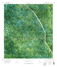
1974 Map of California Slough
USGS Topo · Published 1993About this map
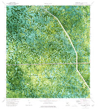
Big Cypress National Preserve defines this landscape of wetlands and water management systems in the mid-1970s. This orthophotomap combines traditional topographic surveying with 1971 aerial photography, revealing the intricate patterns of the Wood Lake Strand and the open expanses of Doctors Prairie. Human intervention is marked by the sharp geometric lines of the Everglades Parkway (Toll Road), which cuts horizontally across the central terrain. Along the eastern edge, the Levee 28 Interceptor Canal traces the Collier Co Broward Co boundary, illustrating the massive hydrological engineering required to manage the flow through the California Slough. This map provides a clear view of the wilderness just as environmental protection and water control infrastructure were reaching their modern configuration.
Find a feature on this map
7 named features on this map. Tap any name to fly to it.
Don’t see what you’re looking for? This feature index may not catch every label — zoom into the map to look around manually.
Map Details
Editions of this 1974 California Slough Map
Other maps of this area

1956 · West Palm Beach
USGS Topo · 1:250,000

1957 · West Palm Beach
USGS Topo · 1:250,000

1958 · West Palm Beach
USGS Topo · 1:250,000

1973 · Everglades 3 NE
USGS Topo · 1:24,000

1974 · Everglades 2 SW
USGS Topo · 1:24,000

1974 · Immokalee 1 SE
USGS Topo · 1:24,000

1974 · Everglades 2 SE
USGS Topo · 1:24,000
1974 · Everglades 3 SW
USGS Topo · 1:24,000
1974 · Immokalee 4 NE
USGS Topo · 1:24,000
1974 · Everglades 3 NW
USGS Topo · 1:24,000