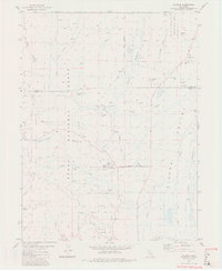
1981 Map of Calpine
USGS Topo · Published 1981About this map
Sierra Valley and the surrounding timberlands of the Plumas National Forest and Tahoe National Forest meet at this mountain-valley junction. The settlement of Calpine serves as a central hub, situated near the Calpine Res and an early Landing Strip. The map reveals the legacy of the local timber and transport economy through the presence of an Old Railroad Grade winding through Folchi Meadows and near McPherrin Camp. This 1981 survey documents a transition from industrial exploitation to a landscape increasingly defined by public forest management. Water resources are plentiful, with Knuthson Creek and the West Fork Carman Valley feeding the lower meadows, while several Flowing Wells and a complex system of Canals and Channels support the agricultural flats of the valley floor.
Find a feature on this map
41 named features on this map. Tap any name to fly to it.
Don’t see what you’re looking for? This feature index may not catch every label — zoom into the map to look around manually.
Map Details
Editions of this 1981 Calpine Map
2 editions found
Other maps of this area

1890 · Sierraville
USGS Topo · 1:125,000

1891 · Downieville
USGS Topo · 1:125,000

1892 · Sierraville
USGS Topo · 1:125,000

1893 · Downieville
USGS Topo · 1:125,000

1894 · Sierraville
USGS Topo · 1:125,000

1895 · Downieville
USGS Topo · 1:125,000

1896 · Downieville
USGS Topo · 1:125,000

1897 · Downieville
USGS Topo · 1:125,000

1937 · Blairsden
USGS Topo · 1:48,000

1943 · Blairsden
USGS Topo · 1:62,500