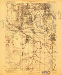
1901 Map of Calumet
USGS Topo · Published 1916About this map
Calumet Lake and its industrial surroundings define this area of the Illinois-Indiana borderlands, captured during a period of massive rail and residential expansion. The complex path of the Little Calumet River snakes through southern Cook County, connecting established hubs like Blue Island and Pullman with newer settlements such as West Harvey and Burnham. This survey reveals a landscape transformed by transportation, where numerous competing lines like the Michigan Central R.R. and Chicago Junction R.R. converge at critical junctions like Thornton Junction.
Find a feature on this map
75 named features on this map. Tap any name to fly to it.
Don’t see what you’re looking for? This feature index may not catch every label — zoom into the map to look around manually.
Map Details
Editions of this 1901 Calumet Map
5 editions found

Other maps of this area

1889 · Chicago
USGS Topo · 1:62,500

1890 · Des Plaines
USGS Topo · 1:62,500

1891 · Chicago
USGS Topo · 1:62,500

1891 · Riverside
USGS Topo · 1:62,500

1892 · Calumet
USGS Topo · 1:62,500

1893 · Calumet
USGS Topo · 1:62,500

1893 · Riverside
USGS Topo · 1:62,500

1894 · Des Plaines
USGS Topo · 1:62,500

1900 · Chicago
USGS Topo · 1:62,500

1900 · Des Plaines
USGS Topo · 1:62,500