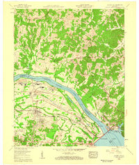
1958 Map of Calvert City
USGS Topo · Published 1959About this map
The Tennessee River dominates this mid-century landscape, serving as the boundary between Livingston and Marshall counties just as the regional infrastructure was being reshaped. This area shows a significant industrial and transport transition, anchored by the massive Kentucky Dam and the resulting Kentucky Lake to the southeast. The growing community of Calvert City is visible with its developing industrial footprint and rail connections along the Illinois Central line, which also serves Gilbertsville and the W Gilbertsville Station.
Find a feature on this map
37 named features on this map. Tap any name to fly to it.
Don’t see what you’re looking for? This feature index may not catch every label — zoom into the map to look around manually.
Map Details
Editions of this 1958 Calvert City Map
3 editions found
Other maps of this area

1928 · Eddyville
USGS Topo · 1:48,000

1929 · Smithland
USGS Topo · 1:62,500

1931 · Eddyville
USGS Topo · 1:62,500

1936 · Elva
USGS Topo · 1:24,000

1936 · Eddyville
USGS Topo · 1:48,000

1936 · Grand Rivers
USGS Topo · 1:24,000

1936 · Smithland
USGS Topo · 1:48,000

1936 · Benton
USGS Topo · 1:48,000

1936 · Birmingham
USGS Topo · 1:24,000

1936 · Golden Pond
USGS Topo · 1:48,000