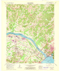
1958 Map of Calvert City
USGS Topo · Published 1969About this map
Calvert City and Gilbertsville anchor this mid-century survey, revealing a landscape defined by industrial expansion and the massive engineering of the Tennessee River. The 1968 revisions, highlighted in purple, document significant change along the riverfront, including new filtration plants, substations, and tailings ponds that contrast with the rural character of the northern hills. The completion of the Kentucky Dam has transformed the river into Kentucky Lake, establishing the Kentucky Dam Village State Park and the Kentucky Dam Tree Nursery as prominent regional landmarks.
Find a feature on this map
35 named features on this map. Tap any name to fly to it.
Don’t see what you’re looking for? This feature index may not catch every label — zoom into the map to look around manually.
Map Details
Editions of this 1958 Calvert City Map
3 editions found
Other maps of this area

1928 · Eddyville
USGS Topo · 1:48,000

1929 · Smithland
USGS Topo · 1:62,500

1931 · Eddyville
USGS Topo · 1:62,500

1936 · Elva
USGS Topo · 1:24,000

1936 · Eddyville
USGS Topo · 1:48,000

1936 · Grand Rivers
USGS Topo · 1:24,000

1936 · Smithland
USGS Topo · 1:48,000

1936 · Benton
USGS Topo · 1:48,000

1936 · Birmingham
USGS Topo · 1:24,000

1936 · Golden Pond
USGS Topo · 1:48,000