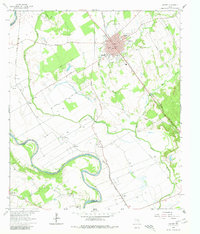
1962 Map of Calvert
USGS Topo · Published 1980About this map
The Brazos River meanders along the Robertson and Milam County line, defining a landscape of fertile bottomlands and transport hubs during the early 1960s. The town of Calvert serves as the central focal point, showing a developed grid and essential community structures like St Paul Ch and Spilker High Sch. The region's economy is clearly visible through the dual paths of the Missouri Pacific Railroad and the Southern Pacific Railroad, which converge at Calvert Junction.
Find a feature on this map
48 named features on this map. Tap any name to fly to it.
Don’t see what you’re looking for? This feature index may not catch every label — zoom into the map to look around manually.
Map Details
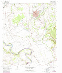
Editions of this 1962 Calvert Map
3 editions found
Other maps of this area

1954 · Waco
USGS Topo · 1:250,000

1954 · Austin
USGS Topo · 1:250,000

1955 · Waco
USGS Topo · 1:250,000

1961 · Hanover
USGS Topo · 1:24,000

1961 · Hearne North
USGS Topo · 1:24,000

1961 · Baileyville
USGS Topo · 1:24,000

1961 · Hearne South
USGS Topo · 1:24,000

1962 · Calvert
USGS Topo · 1:24,000

1962 · Maysfield
USGS Topo · 1:24,000

1962 · Hammond
USGS Topo · 1:24,000