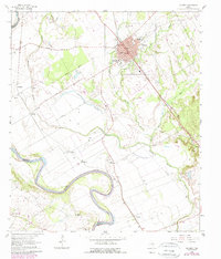
1962 Map of Calvert
USGS Topo · Published 1989About this map
Calvert serves as the focal point of this Robertson County survey, situated at the junction of rail and river commerce near the winding Brazos River. The town layout is densely detailed, featuring Virginia Field Park and several historic congregations such as St Paul Ch and Bethel Ch. Beyond the town limits, the landscape transitions into a network of creek bottoms and agricultural lands defined by Sandy Creek and the Little Brazos River.
Find a feature on this map
38 named features on this map. Tap any name to fly to it.
Don’t see what you’re looking for? This feature index may not catch every label — zoom into the map to look around manually.
Map Details
Editions of this 1962 Calvert Map
3 editions found
Other maps of this area

1954 · Waco
USGS Topo · 1:250,000

1954 · Austin
USGS Topo · 1:250,000

1955 · Waco
USGS Topo · 1:250,000

1961 · Hanover
USGS Topo · 1:24,000

1961 · Hearne North
USGS Topo · 1:24,000

1961 · Baileyville
USGS Topo · 1:24,000

1961 · Hearne South
USGS Topo · 1:24,000

1962 · Calvert
USGS Topo · 1:24,000

1962 · Maysfield
USGS Topo · 1:24,000

1962 · Hammond
USGS Topo · 1:24,000