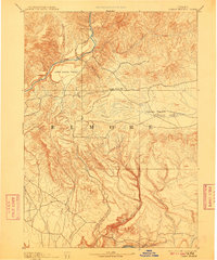
1893 Map of Camas Prairie
USGS Topo · Published 1909About this map
The Boise River and Snake River anchor the drainage patterns of this high-desert and mountain landscape, surveyed years before modern irrigation projects transformed the region. The map captures a sparsely populated interior where small settlements like Pine Grove and High Prairie served as early outposts for ranchers and travelers moving between the river basins. The topography is dominated by the distinct flat expanses of Camas Prairie and Little Camas Prairie, which stand in sharp contrast to the deeply incised canyons of Little Canon Creek and King Hill Creek. These natural corridors provided critical routes for early movement through the difficult terrain. Geographer A.H. Thompson and topographer W.T. Griswold recorded a network of drainage systems including Malad River, Fall Creek, and Cold Spring Creek, documenting the fundamental hydrology of the area at the close of the nineteenth century.
Find a feature on this map
20 named features on this map. Tap any name to fly to it.
Don’t see what you’re looking for? This feature index may not catch every label — zoom into the map to look around manually.
Map Details
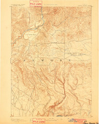
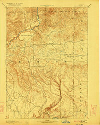
Editions of this 1893 Camas Prairie Map
4 editions found
Other maps of this area

1892 · Mountain Home
USGS Topo · 1:125,000

1892 · Camas Prairie
USGS Topo · 1:125,000

1893 · Mountain Home
USGS Topo · 1:125,000

1893 · Camas Prairie
USGS Topo · 1:125,000

1894 · Idaho Basin
USGS Topo · 1:125,000

1894 · Rocky Bar
USGS Topo · 1:125,000

1900 · Sawtooth
USGS Topo · 1:125,000

1947 · Indian Cove
USGS Topo · 1:24,000

1947 · Hammett
USGS Topo · 1:24,000

1947 · Glenns Ferry
USGS Topo · 1:24,000