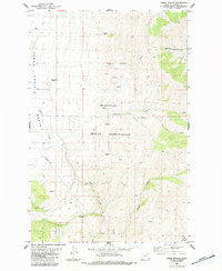
1984 Map of Camas Prairie
USGS Topo · Published 1984About this map
The Flathead Indian Reservation dominates the landscape of this 1980s Montana survey, where the wide Camas Prairie Basin meets the more dissected terrain of the surrounding hills. Settlement is focused at Camas Prairie, a small outpost defined by its proximity to several Wells and a network of seasonal watercourses. The hydrology is a defining characteristic of the area, with Camas Creek winding through the valley while the eastern slopes are drained by Whiskey Creek and numerous named drainages including Whiskey Gulch and Coppedge Gulch. Land use patterns at this time appear split between rangeland and limited industrial activity, evidenced by scattered Prospects in the higher elevations and a Gravel Pit near the creek. A modern Pipeline cuts across the southern portion of the sheet, tracing a direct path across the natural topography of Wilcox Draw and Clear Creek.
Find a feature on this map
15 named features on this map. Tap any name to fly to it.
Don’t see what you’re looking for? This feature index may not catch every label — zoom into the map to look around manually.
Map Details
Editions of this 1984 Camas Prairie Map
This is the sole edition of this map. No revisions or reprints were ever made.
Other maps of this area

1920 · Flathead Lake
USGS Topo · 1:125,000

1956 · Wallace
USGS Topo · 1:250,000

1959 · Perma
USGS Topo · 1:62,500

1960 · Wallace
USGS Topo · 1:250,000

1964 · Mc Donald
USGS Topo · 1:24,000

1964 · Melton Ranch
USGS Topo · 1:24,000

1964 · Markle Pass
USGS Topo · 1:24,000

1964 · Hot Springs
USGS Topo · 1:24,000

1965 · Oliver Point
USGS Topo · 1:24,000
1980 · Polson
USGS Topo · 1:100,000