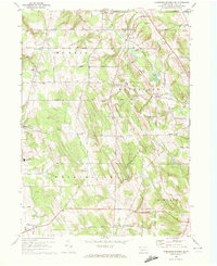
1967 Map of Cambridge Springs NE
USGS Topo · Published 1972About this map
Edinboro anchors the southwestern corner of this Pennsylvania landscape, where a dense network of country roads connects historical hamlets and rural crossroads. The area is defined by the drainage basins of Elk Creek in the north and Little Conneauttee Creek in the south, separated by high ground like South Hill. Family and community history is etched into the landscape at sites like Washington Valley Church and General McLane High School, while numerous corner settlements including Sibleyville, Draketown, and McLallen Corners mark the traditional nodes of local commerce and social life. The presence of several radio towers, including the WICU Radio Towers near the northern boundary, indicates the modernizing infrastructure of the late 1960s. Large tracts of land are preserved within State Game Lands No 102, which borders the McLean and Draketown areas, showing a mix of agricultural use and state-managed wilderness.
Find a feature on this map
64 named features on this map. Tap any name to fly to it.
Don’t see what you’re looking for? This feature index may not catch every label — zoom into the map to look around manually.
Map Details
Editions of this 1967 Cambridge Springs NE Map
Other maps of this area

1899 · Erie
USGS Topo · 1:62,500

1900 · Erie
USGS Topo · 1:62,500

1913 · North East
USGS Topo · 1:62,500

1915 · North East
USGS Topo · 1:62,500

1923 · Cambridge Springs
USGS Topo · 1:62,500

1925 · Cambridge Springs
USGS Topo · 1:62,500

1929 · Union City
USGS Topo · 1:62,500

1932 · Union City
USGS Topo · 1:62,500

1943 · North East
USGS Topo · 1:62,500

1943 · Cambridge Springs
USGS Topo · 1:62,500