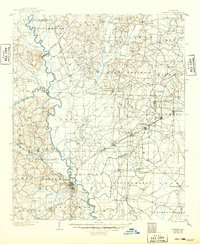
1903 Map of Camden
USGS Topo · Published 1949About this map
The Ouachita River serves as the primary artery through this south Arkansas landscape at the turn of the century, where the river's winding course meets a growing network of timber and transit lines. Camden stands as a central hub at the junction of the river and the St L S W R R, reflecting the era's transition from steamboat traffic to rail-based industry. The map captures an economy in motion, with industrial markers like Eagle Mills, Millville, and a Coal Mine northwest of the river. Beyond the commercial centers, the survey details the rural character of the Free O Valley and the prominent heights of Ecore Fabre Mountain. From the older settlements of Princeton and Holly Springs to the scattered post offices and creek-side crossings, the map documents a territory defined by its complex drainage systems and the expansion of the Arkansas Southwestern R R.
Find a feature on this map
76 named features on this map. Tap any name to fly to it.
Don’t see what you’re looking for? This feature index may not catch every label — zoom into the map to look around manually.
Map Details
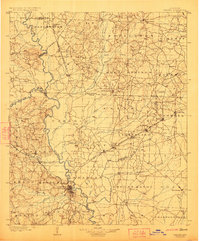
Editions of this 1903 Camden Map
3 editions found
Other maps of this area

1901 · Gurdon
USGS Topo · 1:125,000

1903 · Camden
USGS Topo · 1:125,000

1934 · Moro Bay
USGS Topo · 1:62,500

1938 · Moro Bay
USGS Topo · 1:62,500

1939 · Moro Bay
USGS Topo · 1:62,500

1951 · Camden
USGS Topo · 1:24,000

1953 · El Dorado
USGS Topo · 1:250,000

1955 · Little Rock
USGS Topo · 1:250,000

1956 · Little Rock
USGS Topo · 1:250,000

1957 · El Dorado
USGS Topo · 1:250,000