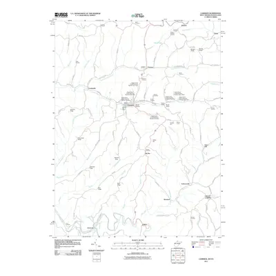
2011 Map of Cameron
USGS Topo · Published 2011About this map
Cameron serves as the focal point for this section of Marshall County, situated along Grave Creek near the unique topographical depression of Ramp Hollow. The landscape is defined by its ridge-and-hollow character, where narrow roads like County Hwy 250/8 follow the high ground of Goshorn Ridge and Grapevine Ridge. A sophisticated system of flood control is evident through numerous installations such as Upper Grave Creek Structure Number One Dam and Upper Grave Creek Structure Number Nine Dam, which protect the lower settlements. Smaller communities including Woodruff, Bellton, and Rocklick are connected by a network of winding runs like Fish Creek and North Fork Grave Creek. For genealogists, the map is particularly valuable for its high density of family and community burial sites, from the Fletcher-Earlwine Cemetery in the north to the Gray Cemetery in the south.
Find a feature on this map
101 named features on this map. Tap any name to fly to it.
Don’t see what you’re looking for? This feature index may not catch every label — zoom into the map to look around manually.
Map Details
Editions of this 2011 Cameron Map
This is the sole edition of this map. No revisions or reprints were ever made.
Other maps of this area

1903 · Littleton
USGS Topo · 1:62,500

1904 · Cameron
USGS Topo · 1:62,500

1905 · Mannington
USGS Topo · 1:62,500

1905 · Rogersville
USGS Topo · 1:62,500

1905 · Littleton
USGS Topo · 1:62,500

1923 · Mannington
USGS Topo · 1:62,500

1924 · Littleton
USGS Topo · 1:62,500

1926 · Littleton
USGS Topo · 1:62,500

1926 · Mannington
USGS Topo · 1:62,500

1935 · Cameron
USGS Topo · 1:62,500