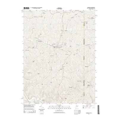
2014 Map of Cameron
USGS Topo · Published 2014About this map
Cameron serves as the central hub of this northern Panhandle landscape, where the town's grid meets the branching valleys of Grave Cr and its tributaries. The terrain is defined by narrow ridges and steep hollows, such as Squirrel Alley, Ramp Hollow, and Strawn Hollow, reflecting a classic Appalachian settlement pattern where roads and small communities like Loudenville, Bellton, and Woodruff follow the winding creek beds or crest the high ground of Fork Ridge.
Find a feature on this map
91 named features on this map. Tap any name to fly to it.
Don’t see what you’re looking for? This feature index may not catch every label — zoom into the map to look around manually.
Map Details
Editions of this 2014 Cameron Map
This is the sole edition of this map. No revisions or reprints were ever made.
Other maps of this area

1903 · Littleton
USGS Topo · 1:62,500

1904 · Cameron
USGS Topo · 1:62,500

1905 · Mannington
USGS Topo · 1:62,500

1905 · Rogersville
USGS Topo · 1:62,500

1905 · Littleton
USGS Topo · 1:62,500

1923 · Mannington
USGS Topo · 1:62,500

1924 · Littleton
USGS Topo · 1:62,500

1926 · Littleton
USGS Topo · 1:62,500

1926 · Mannington
USGS Topo · 1:62,500

1935 · Cameron
USGS Topo · 1:62,500