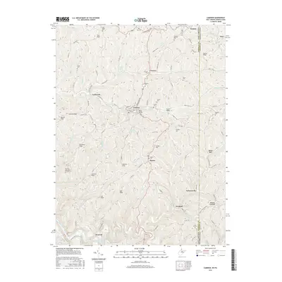
2016 Map of Cameron
USGS Topo · Published 2016About this map
Cameron serves as the primary hub of this highland landscape, where the Waynesburg Pike and the historic Warrior Trail intersect near the West Virginia-Pennsylvania state line. The terrain is characterized by a series of prominent ridges, including Goshorn Ridge, Grapevine Ridge, and Cameron Ridge, which define the drainage basins of Grave Creek and Fish Creek. Small settlements like Loudenville, Woodruff, and Kausooth are scattered along these watercourses and winding mountain roads, often anchored by local landmarks such as Ramp Hollow.
Find a feature on this map
111 named features on this map. Tap any name to fly to it.
Don’t see what you’re looking for? This feature index may not catch every label — zoom into the map to look around manually.
Map Details
Editions of this 2016 Cameron Map
This is the sole edition of this map. No revisions or reprints were ever made.
Other maps of this area

1903 · Littleton
USGS Topo · 1:62,500

1904 · Cameron
USGS Topo · 1:62,500

1905 · Mannington
USGS Topo · 1:62,500

1905 · Rogersville
USGS Topo · 1:62,500

1905 · Littleton
USGS Topo · 1:62,500

1923 · Mannington
USGS Topo · 1:62,500

1924 · Littleton
USGS Topo · 1:62,500

1926 · Littleton
USGS Topo · 1:62,500

1926 · Mannington
USGS Topo · 1:62,500

1935 · Cameron
USGS Topo · 1:62,500