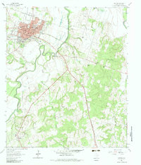
1961 Map of Cameron
USGS Topo · Published 1983About this map
The railroad junction at Cameron serves as a major hub where the Gulf Colorado and Santa Fe and I-Gn & St L lines intersect. This 1961 survey captures the town's residential grid, including streets like West Main Street and Central Ave, alongside vital community landmarks such as Yeo High Sch and the Old City Cem. South of the urban center, the landscape transitions into a mix of riparian bottomlands along the Little River and industrial pockets, including numerous Gravel Pits and the Houston-Oklahoma Oil Field. Smaller rural clusters like Minerva and Hoyte are visible, each anchored by local landmarks such as Hoyte Ch and the Minerva Cem. The distribution of family burial grounds, such as Lumpkin Cem and Griffin Cem, provides a detailed record of the area's ancestral settlements and land ownership patterns.
Find a feature on this map
71 named features on this map. Tap any name to fly to it.
Don’t see what you’re looking for? This feature index may not catch every label — zoom into the map to look around manually.
Map Details
Editions of this 1961 Cameron Map
3 editions found
Other maps of this area

1885 · Taylor
USGS Topo · 1:125,000

1887 · Taylor
USGS Topo · 1:125,000

1894 · Taylor
USGS Topo · 1:125,000

1954 · Austin
USGS Topo · 1:250,000

1956 · Milano
USGS Topo · 1:62,500

1961 · Hanover
USGS Topo · 1:24,000

1961 · Cameron
USGS Topo · 1:24,000

1961 · Rockdale East
USGS Topo · 1:24,000

1962 · Rockdale West
USGS Topo · 1:24,000
1962 · Pettibone
USGS Topo · 1:24,000