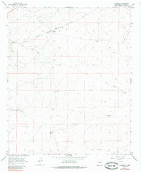
1967 Map of Campbell
USGS Topo · Published 1985About this map
Sterling Ranch and the rail stop at Campbell anchor this high desert landscape during the late 1960s. The region is defined by its wide-ranging ranching operations and the critical path of the Atchison Topeka and Santa Fe railroad, which cuts across the northern terrain. Water management is the primary focus of development here, evidenced by the numerous specialized features like the North Windmill Well, East Windmill Well, and White Tank.
Find a feature on this map
16 named features on this map. Tap any name to fly to it.
Don’t see what you’re looking for? This feature index may not catch every label — zoom into the map to look around manually.
Map Details
Editions of this 1967 Campbell Map
2 editions found
Other maps of this area

1949 · Sardine Mountain
USGS Topo · 1:24,000

1949 · L-E Ranch
USGS Topo · 1:24,000

1950 · Comanche Spring
USGS Topo · 1:24,000

1955 · Roswell
USGS Topo · 1:250,000

1958 · Roswell
USGS Topo · 1:250,000

1962 · Roswell
USGS Topo · 1:250,000

1962 · Eightmile Draw
USGS Topo · 1:24,000

1962 · Acme
USGS Topo · 1:24,000
1967 · Campbell
USGS Topo · 1:24,000

1967 · Haystack Mountain
USGS Topo · 1:24,000