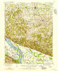
1916 Map of Campbell Hill
USGS Topo · Published 1953About this map
The Mississippi River forms a massive corridor along the southwestern edge of this survey, defining the border between Illinois and Missouri. High bluffs and intricate drainage networks, including Marys River and Kinkaid Creek, dominate the interior terrain. A dense network of rural schoolhouses serves the scattered settlements, with names like Denmark School, Tangen School, and Maple Hill School indicating a robust local community system during the early twentieth century.
Find a feature on this map
85 named features on this map. Tap any name to fly to it.
Don’t see what you’re looking for? This feature index may not catch every label — zoom into the map to look around manually.
Map Details
Editions of this 1916 Campbell Hill Map
3 editions found
Other maps of this area

1910 · Murphysboro
USGS Topo · 1:62,500

1912 · Baldwin
USGS Topo · 1:62,500

1914 · Baldwin
USGS Topo · 1:62,500

1914 · Coulterville
USGS Topo · 1:62,500

1915 · Chester
USGS Topo · 1:62,500

1916 · Campbell Hill
USGS Topo · 1:62,500

1917 · Coulterville
USGS Topo · 1:62,500

1918 · Altenburg
USGS Topo · 1:62,500

1918 · Campbell Hill
USGS Topo · 1:62,500

1923 · Perryville
USGS Topo · 1:62,500