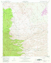
1948 Map of Campo Bonito
USGS Topo · Published 1982About this map
Campo Bonito and its surrounding mining operations anchor this terrain on the northeastern slopes of the Santa Catalina Mountains. The landscape is defined by a series of significant mining works including the Highjinks Mine, Southern Belle Mine, Old Maudina Mine, and Bonito Mine, reflecting the intensive extraction history of the area. Settlement patterns are characterized by a network of established ranching properties, most notably the Kannally Ranch, Cherry Valley Ranch, and American Flag Ranch.
Find a feature on this map
39 named features on this map. Tap any name to fly to it.
Don’t see what you’re looking for? This feature index may not catch every label — zoom into the map to look around manually.
Map Details
Editions of this 1948 Campo Bonito Map
5 editions found
Other maps of this area

1904 · Tucson
USGS Topo · 1:125,000

1905 · Tucson
USGS Topo · 1:125,000

1911 · Winkelman
USGS Topo · 1:125,000

1913 · Winkelman
USGS Topo · 1:125,000

1948 · Clark Ranch
USGS Topo · 1:24,000

1948 · Mammoth
USGS Topo · 1:62,500

1948 · Mammoth
USGS Topo · 1:24,000

1948 · Campo Bonito
USGS Topo · 1:24,000

1948 · Peppersauce Wash
USGS Topo · 1:24,000

1949 · Clark Ranch
USGS Topo · 1:24,000