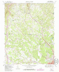
1968 Map of Cana
USGS Topo · Published 1986About this map
The Virginia-North Carolina state line bisects this landscape, separating Carroll County and Surry County as the Piedmont begins its ascent toward the Blue Ridge. The Blue Ridge Parkway skirts the western edge of the quadrangle, passing beneath Sugarloaf and Wheeler Knob. This 1968 survey, later updated with mid-1980s aerial revisions, documents a rural mountain community defined by a dense network of country churches and schools. Local life is anchored by settlements like Cana and Toast, while institutions such as the North Surry High School and St Pauls High School serve the growing population near the state border. Numerous family-named landmarks and small congregations, including Flowers Gap Church and Midway Church, are scattered along the drainage basins of Pauls Creek and Stewarts Creek, illustrating a well-established pattern of high-country settlement.
Find a feature on this map
59 named features on this map. Tap any name to fly to it.
Don’t see what you’re looking for? This feature index may not catch every label — zoom into the map to look around manually.
Map Details
Editions of this 1968 Cana Map
Other maps of this area

1889 · Hillsville
USGS Topo · 1:125,000

1891 · Yadkinville
USGS Topo · 1:125,000

1892 · Hillsville
USGS Topo · 1:125,000

1893 · Yadkinville
USGS Topo · 1:125,000

1896 · Hillsville
USGS Topo · 1:125,000

1931 · Galax
USGS Topo · 1:48,000

1933 · Galax
USGS Topo · 1:62,500

1953 · Winston-Salem
USGS Topo · 1:250,000

1955 · Winston-Salem
USGS Topo · 1:250,000

1957 · Mount Airy
USGS Topo · 1:62,500