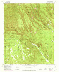
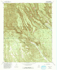
1953 Map of Canada
USGS Topo · Published 1978About this map
Santa Fe National Forest landscapes define this 1953 survey, centered on the complex intersection of tribal lands and mining interests in New Mexico. The map details the Cañada de Cochiti Grant (Tribal Indian Land of Jemez Pueblo) and the Pueblo de Cochiti Grant, illustrating a geography deeply tied to ancestral boundaries and natural resources. Industrial activity is prominent, with several Pumice Mines (Active) and a Gravel Pit scattered across the volcanic terrain.
Find a feature on this map
40 named features on this map. Tap any name to fly to it.
Don’t see what you’re looking for? This feature index may not catch every label — zoom into the map to look around manually.
Map Details
Editions of this 1953 Canada Map
6 editions found

Other maps of this area

1890 · Jemes
USGS Topo · 1:125,000

1892 · Jemes
USGS Topo · 1:125,000

1892 · Santa Clara
USGS Topo · 1:125,000

1937 · Jemez Springs
USGS Topo · 1:48,000

1943 · Jemez
USGS Topo · 1:62,500

1944 · Jemez Springs
USGS Topo · 1:62,500

1952 · Jemez Springs
USGS Topo · 1:62,500

1952 · Frijoles
USGS Topo · 1:24,000

1952 · Jemez
USGS Topo · 1:62,500

1953 · Cochiti Dam
USGS Topo · 1:24,000