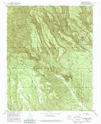
1953 Map of Canada
USGS Topo · Published 1985About this map
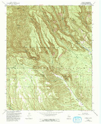
Santa Fe National Forest landscapes define this area of Sandoval County, where deep canyons and high mesas dictate the patterns of transit and settlement. The map documents the industrial and residential history of the high desert, specifically marking the Albemarle (Site) and Cañada (Ruins), alongside the working Pumice Mines (Active) that operated during the mid-20th century. Rugged access routes like the Old Albemarle Road and the Bland Bear Springs Trail connect these remote outposts across challenging terrain such as Oaks Mesa and Cochiti Mesa.
Find a feature on this map
56 named features on this map. Tap any name to fly to it.
Don’t see what you’re looking for? This feature index may not catch every label — zoom into the map to look around manually.
Map Details
Editions of this 1953 Canada Map
6 editions found

Other maps of this area

1890 · Jemes
USGS Topo · 1:125,000

1892 · Jemes
USGS Topo · 1:125,000

1892 · Santa Clara
USGS Topo · 1:125,000

1937 · Jemez Springs
USGS Topo · 1:48,000

1943 · Jemez
USGS Topo · 1:62,500

1944 · Jemez Springs
USGS Topo · 1:62,500

1952 · Jemez Springs
USGS Topo · 1:62,500

1952 · Frijoles
USGS Topo · 1:24,000

1952 · Jemez
USGS Topo · 1:62,500

1953 · Cochiti Dam
USGS Topo · 1:24,000