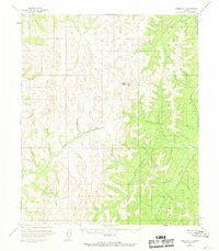
1954 Map of Candle A-1
USGS Topo · Published 1968About this map
Ungalik River and the Kateel River define the hydrographic character of this interior Alaskan landscape, which was primarily mapped via photogrammetric methods from aerial photography taken in the early 1950s. The terrain transitions between river basins through several significant elevations, most notably at Traverse Peak and VABM High Peak 2688. This mid-century survey reflects the wilderness of the Yukon-Koyukuk region before significant infrastructure development, emphasizing natural drainages like Caribou Creek. The absence of mapped roads or permanent settlements highlight the area's isolation during the post-war era, providing a baseline for environmental historians and those studying the remote river networks of the Alaska interior.
Find a feature on this map
5 named features on this map. Tap any name to fly to it.
Don’t see what you’re looking for? This feature index may not catch every label — zoom into the map to look around manually.
Map Details
Editions of this 1954 Candle A-1 Map
3 editions found
Other maps of this area

1945 · Nulato
USGS Topo · 1:250,000

1948 · Norton Bay
USGS Topo · 1:250,000

1951 · Candle
USGS Topo · 1:250,000

1951 · Nulato
USGS Topo · 1:250,000

1951 · Norton Bay
USGS Topo · 1:250,000

1951 · Kateel River
USGS Topo · 1:250,000

1952 · Nulato
USGS Topo · 1:250,000

1954 · Candle A-2
USGS Topo · 1:63,360

1954 · Candle A-1
USGS Topo · 1:63,360

1954 · Norton Bay D-2
USGS Topo · 1:63,360