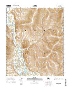
2014 Map of Candle A-4 SW
USGS Topo · Published 2014About this map
Koyuk River winds through this subarctic terrain in the southern Seward Peninsula, creating a series of complex oxbows and river bends. The landscape is defined by the drainage patterns of tributaries like Alameda Cr, which feeds into the larger river system from the west. Human activity is notably sparse in this remote region, marked primarily by the presence of the Road To E Fork in the western half of the map. This route suggests a critical link to gold mining operations or seasonal camps further inland, characteristic of the transport networks in the Nome region. The inclusion of the Koy2013 marker indicates contemporary land management or surveying points within the extensive township and range boundaries that organize this section of the Alaskan wilderness.
Find a feature on this map
11 named features on this map. Tap any name to fly to it.
Don’t see what you’re looking for? This feature index may not catch every label — zoom into the map to look around manually.
Map Details
Editions of this 2014 Candle A-4 SW Map
This is the sole edition of this map. No revisions or reprints were ever made.
Other maps of this area

1948 · Norton Bay
USGS Topo · 1:250,000

1950 · Norton Bay D-5
USGS Topo · 1:63,360

1950 · Candle A-5
USGS Topo · 1:63,360

1950 · Norton Bay D-4
USGS Topo · 1:63,360

1951 · Candle
USGS Topo · 1:250,000

1951 · Norton Bay
USGS Topo · 1:250,000

1955 · Candle
USGS Topo · 1:250,000

1955 · Norton Bay
USGS Topo · 1:250,000
1955 · Candle A-4
USGS Topo · 1:63,360

1964 · Candle
USGS Topo · 1:250,000