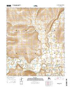
2014 Map of Candle A-5 NW
USGS Topo · Published 2014About this map
Koyuk River and Peace River dominate this remote northern landscape, where intricate fluvial patterns and shifting oxbows reveal the dynamic nature of the drainage basin. The terrain is defined by the convergence of these major waterways alongside smaller tributaries like Willow Cr and Stephensons Stream. This 2014 survey documents the hydrography of the region in high detail, illustrating the complex network of sloughs and wetland marshes that characterize the river valleys between the townships of t3s r14w and t4s r13w. The absence of roads or permanent settlements in this sector emphasizes the preserved wilderness character of the interior, making it a critical reference for understanding the natural geography of the Seward Peninsula region before further environmental shifts.
Find a feature on this map
8 named features on this map. Tap any name to fly to it.
Don’t see what you’re looking for? This feature index may not catch every label — zoom into the map to look around manually.
Map Details
Editions of this 2014 Candle A-5 NW Map
This is the sole edition of this map. No revisions or reprints were ever made.
Other maps of this area

1950 · Candle A-6
USGS Topo · 1:63,360

1950 · Candle B-5
USGS Topo · 1:63,360

1950 · Candle A-5
USGS Topo · 1:63,360

1950 · Candle B-6
USGS Topo · 1:63,360

1951 · Candle
USGS Topo · 1:250,000

1955 · Candle
USGS Topo · 1:250,000

1964 · Candle
USGS Topo · 1:250,000
2014 · Candle A-5 NE
USGS Topo · 1:25,000
2014 · Candle A-5 SE
USGS Topo · 1:25,000
2014 · Candle B-5 SE
USGS Topo · 1:25,000