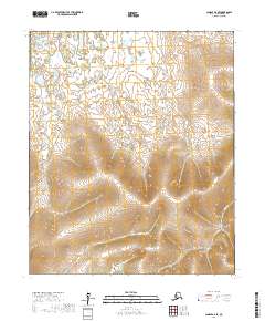
2017 Map of Candle A-6 SE
USGS Topo · Published 2017About this map
Quartz Creek and Willow Creek are the primary drainage systems defining this remote landscape in the Nome Census Area. This 2017 survey reveals the intricate topography of the Seward Peninsula, where these waterways have carved distinct valleys through the high ground. The map details the Public Land Survey System grids, including sections of t4s r15w, t5s r14w, and t6s r15w, which provide a precise framework for the undeveloped terrain. While devoid of permanent settlements or roads, the arrangement of the stream networks suggests a classic Alaskan interior landscape of tundra and watershed, where the land remains largely defined by its natural hydrology and elevation contours rather than human infrastructure.
Find a feature on this map
8 named features on this map. Tap any name to fly to it.
Don’t see what you’re looking for? This feature index may not catch every label — zoom into the map to look around manually.
Map Details
Editions of this 2017 Candle A-6 SE Map
This is the sole edition of this map. No revisions or reprints were ever made.
Other maps of this area

1948 · Norton Bay
USGS Topo · 1:250,000

1950 · Norton Bay D-6
USGS Topo · 1:63,360

1950 · Norton Bay D-5
USGS Topo · 1:63,360

1950 · Candle A-6
USGS Topo · 1:63,360

1950 · Candle A-5
USGS Topo · 1:63,360

1951 · Candle
USGS Topo · 1:250,000

1951 · Norton Bay
USGS Topo · 1:250,000

1955 · Candle
USGS Topo · 1:250,000

1955 · Norton Bay
USGS Topo · 1:250,000

1964 · Candle
USGS Topo · 1:250,000