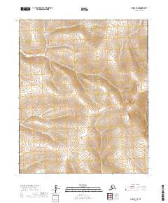
2017 Map of Candle B-6 SE
USGS Topo · Published 2017About this map
The remote Seward Peninsula interior is documented here through a modern lens, focusing on the intricate topography of the Nome Census Area. This region, defined by its lack of established roads or named settlements, is mapped through its foundational Public Land Survey System boundaries, including T1s R15w and T1s R14w. The landscape consists of unnamed ridges and drainage basins, reflecting the deep isolation of the Alaskan wilderness where human footprint is represented only by surveyed township lines like T2s R15w and T2s R14w. For those studying the geography of the Candle B-6 SE quadrangle, the map illustrates the raw terrain and drainage patterns that characterize this part of the Alaskan Arctic, providing a baseline for understanding land use and potential mineral exploration routes in a region where natural features take precedence over built infrastructure.
Find a feature on this map
6 named features on this map. Tap any name to fly to it.
Don’t see what you’re looking for? This feature index may not catch every label — zoom into the map to look around manually.
Map Details
Editions of this 2017 Candle B-6 SE Map
This is the sole edition of this map. No revisions or reprints were ever made.
Other maps of this area

1950 · Candle A-6
USGS Topo · 1:63,360

1950 · Candle B-5
USGS Topo · 1:63,360

1950 · Candle A-5
USGS Topo · 1:63,360

1950 · Candle B-6
USGS Topo · 1:63,360

1951 · Candle
USGS Topo · 1:250,000

1955 · Candle
USGS Topo · 1:250,000

1964 · Candle
USGS Topo · 1:250,000
2014 · Candle B-5 NW
USGS Topo · 1:25,000
2014 · Candle B-6 NE
USGS Topo · 1:25,000
2014 · Candle A-5 NW
USGS Topo · 1:25,000