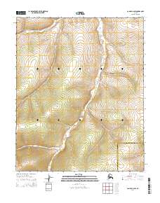
2014 Map of Candle C-2 SW
USGS Topo · Published 2014About this map
Kalusuk Cr meanders southward through this remote interior landscape, situated along the jurisdictional divide between the Northwest Arctic Borough and the Nome Census Area. The terrain is defined by the winding course of Little Kalusuk Creek in the northwest, which feeds into the larger drainage system of the region. This 2014 survey documents a territory dominated by natural hydrography and elevation contours, lacking any modern road infrastructure or permanent settlements. The map highlights the intersection of several townships, including t3n r6w, t2n r6w, and t1n r6w, providing a precise record of the Public Land Survey System grid across this uninhabited Arctic expanse. Researchers of the Seward Peninsula's geography can trace the specific watercourses that define these borough boundaries.
Find a feature on this map
9 named features on this map. Tap any name to fly to it.
Don’t see what you’re looking for? This feature index may not catch every label — zoom into the map to look around manually.
Map Details
Editions of this 2014 Candle C-2 SW Map
This is the sole edition of this map. No revisions or reprints were ever made.
Other maps of this area

1951 · Candle
USGS Topo · 1:250,000

1954 · Candle C-2
USGS Topo · 1:63,360

1954 · Candle B-2
USGS Topo · 1:63,360

1955 · Candle
USGS Topo · 1:250,000

1955 · Candle B-3
USGS Topo · 1:63,360

1955 · Candle C-3
USGS Topo · 1:63,360

1964 · Candle
USGS Topo · 1:250,000
2014 · Candle C-3 NE
USGS Topo · 1:25,000
2014 · Candle C-3 SE
USGS Topo · 1:25,000
2014 · Candle B-2 NW
USGS Topo · 1:25,000