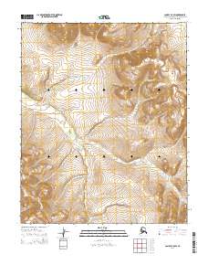
2014 Map of Candle C-5 SW
USGS Topo · Published 2014About this map
Weather Ridge dominates the southwestern corner of this landscape, rising above a complex network of arctic waterways in the Northwest Arctic region. The drainage patterns here are defined by the convergence of Buck Cr and Deer Cr, which feed into the meandering path of Quartz Cr. This 2014 survey by the U.S. Geological Survey illustrates a remote terrain where the absence of roads or permanent settlements emphasizes the dominance of natural landforms and the Public Land Survey System. The grid of township and range lines, such as t3n r13w, provides the only human-imposed structure over the shifting contours and seasonal streams of the Alaskan interior.
Find a feature on this map
13 named features on this map. Tap any name to fly to it.
Don’t see what you’re looking for? This feature index may not catch every label — zoom into the map to look around manually.
Map Details
Editions of this 2014 Candle C-5 SW Map
This is the sole edition of this map. No revisions or reprints were ever made.
Other maps of this area

1950 · Candle C-5
USGS Topo · 1:63,360

1950 · Candle B-5
USGS Topo · 1:63,360

1950 · Candle B-6
USGS Topo · 1:63,360

1950 · Candle C-6
USGS Topo · 1:63,360

1951 · Candle
USGS Topo · 1:250,000

1955 · Candle
USGS Topo · 1:250,000

1964 · Candle
USGS Topo · 1:250,000
2014 · Candle C-5 NW
USGS Topo · 1:25,000
2014 · Candle C-5 NE
USGS Topo · 1:25,000
2014 · Candle C-6 SE
USGS Topo · 1:25,000