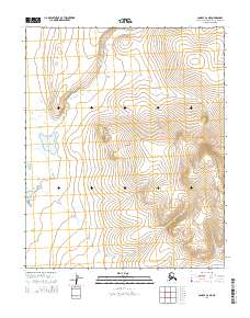
2014 Map of Candle C-6 NE
USGS Topo · Published 2014About this map
The Seward Peninsula landscape is defined by its complex drainage systems and high-altitude contours in this remote region of the Northwest Arctic Borough. The hydrology of the area is anchored by Hunter Lake and a series of winding watercourses including Hunter Cr, Linda Cr, and Connolly Cr. These features demonstrate the natural drainage patterns of the Alaskan interior, where seasonal runoff and permafrost influence the geography. The absence of built infrastructure or named roads emphasizes the untouched character of the terrain during this period. Researchers can trace the pathways of Coal Cr as it navigates the high elevations, providing insight into the physical geography of the peninsula's interior before modern development or climate shifts altered these northern waterways.
Find a feature on this map
10 named features on this map. Tap any name to fly to it.
Don’t see what you’re looking for? This feature index may not catch every label — zoom into the map to look around manually.
Map Details
Editions of this 2014 Candle C-6 NE Map
This is the sole edition of this map. No revisions or reprints were ever made.
Other maps of this area

1950 · Candle C-5
USGS Topo · 1:63,360

1950 · Candle C-6
USGS Topo · 1:63,360

1951 · Candle
USGS Topo · 1:250,000

1951 · Candle D-5
USGS Topo · 1:63,360

1951 · Candle D-6
USGS Topo · 1:63,360

1955 · Candle
USGS Topo · 1:250,000

1964 · Candle
USGS Topo · 1:250,000
2014 · Candle C-5 NW
USGS Topo · 1:25,000
2014 · Candle C-6 NW
USGS Topo · 1:25,000
2014 · Candle D-6 SE
USGS Topo · 1:25,000