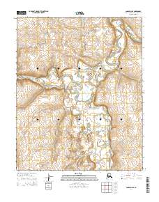
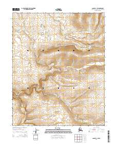
2014 Map of Candle D-4 SE
USGS Topo · Published 2014About this map
The Buckland River meanders across this sub-arctic terrain, defining a landscape shaped by water and elevation within the Northwest Arctic Borough. The river's path is joined by significant tributaries including the W Fork Buckland River, which flows through the southern half of the quadrangle. Smaller drainages like Pack-Sack Cr and Harvey Cr feed into the main channel from the north, illustrating a complex hydrological network. While the area lacks named settlements or developed infrastructure, the detailed topographic lines reveal the undulating drainage basins and low ridges that characterize this part of the Alaskan interior. This survey provides a precise look at the natural geography before any major modern land use changes, serving as a primary reference for the physical character of the region's river systems.
Find a feature on this map
10 named features on this map. Tap any name to fly to it.
Don’t see what you’re looking for? This feature index may not catch every label — zoom into the map to look around manually.
Map Details
Editions of this 2014 Candle D-4 SE Map
This is the sole edition of this map. No revisions or reprints were ever made.
Other maps of this area

1951 · Candle
USGS Topo · 1:250,000

1955 · Candle
USGS Topo · 1:250,000

1955 · Candle D-4
USGS Topo · 1:63,360

1955 · Candle C-4
USGS Topo · 1:63,360

1955 · Candle C-3
USGS Topo · 1:63,360
1955 · Candle D-3
USGS Topo · 1:63,360

1964 · Candle
USGS Topo · 1:250,000
2014 · Candle D-3 SW
USGS Topo · 1:25,000
2014 · Candle D-4 NE
USGS Topo · 1:25,000
2014 · Candle D-3 NW
USGS Topo · 1:25,000