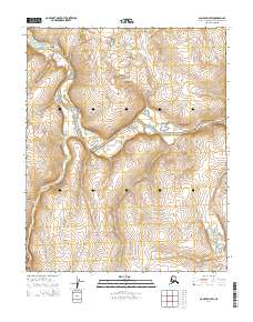
2014 Map of Candle D-4 SW
USGS Topo · Published 2014About this map
The Buckland River carves a winding path through the Northwest Arctic Borough in this 2014 survey, illustrating a remote landscape defined by its expansive drainage systems. The water network is further defined by the Kilulikpuk Cr and the Iyou River, which flow across the township boundaries of T5N R11W and T5N R10W. Without established roads or settlements, the map focuses on the precise hydrography and topography of this subarctic wilderness, where the shifting river channels and seasonal creeks serve as the primary geographical markers. This detailed elevation study by the U.S. Geological Survey provides a foundational view of the region's natural drainage before any significant modern infrastructure development.
Find a feature on this map
9 named features on this map. Tap any name to fly to it.
Don’t see what you’re looking for? This feature index may not catch every label — zoom into the map to look around manually.
Map Details
Editions of this 2014 Candle D-4 SW Map
This is the sole edition of this map. No revisions or reprints were ever made.
Other maps of this area

1950 · Candle C-5
USGS Topo · 1:63,360

1951 · Candle
USGS Topo · 1:250,000

1951 · Candle D-5
USGS Topo · 1:63,360

1955 · Candle
USGS Topo · 1:250,000

1955 · Candle D-4
USGS Topo · 1:63,360

1955 · Candle C-4
USGS Topo · 1:63,360

1964 · Candle
USGS Topo · 1:250,000
2014 · Candle D-4 NE
USGS Topo · 1:25,000
2014 · Candle C-5 NE
USGS Topo · 1:25,000
2014 · Candle C-4 NE
USGS Topo · 1:25,000