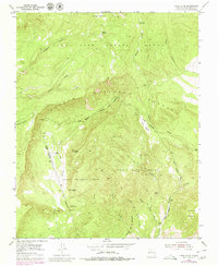
1953 Map of Canjilon SE
USGS Topo · Published 1980About this map
The northern reaches of the Juan Jose Lobato Grant and adjacent land grants define this high-altitude landscape in New Mexico. The terrain is deeply incised by complex drainage systems, notably Cañon del Cobre and the Cañon Blanco, which highlight the geologic erosion characteristic of the region. This 1953 survey, with revisions from 1979, illustrates a wilderness area where human activity is primarily limited to resource extraction and forest management within the Carson National Forest.
Find a feature on this map
33 named features on this map. Tap any name to fly to it.
Don’t see what you’re looking for? This feature index may not catch every label — zoom into the map to look around manually.
Map Details
Editions of this 1953 Canjilon SE Map
4 editions found
Other maps of this area

1918 · Abiquiu
USGS Topo · 1:125,000

1953 · Canones
USGS Topo · 1:24,000

1953 · Abiquiu
USGS Topo · 1:24,000

1953 · Medanales
USGS Topo · 1:24,000

1953 · Valle Grande Peak
USGS Topo · 1:24,000

1953 · Magote Peak
USGS Topo · 1:24,000

1953 · Canjilon
USGS Topo · 1:24,000

1953 · El Rito
USGS Topo · 1:24,000

1953 · Canjilon SE
USGS Topo · 1:24,000

1953 · Ghost Ranch
USGS Topo · 1:24,000