
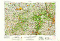
1962 Map of Canton
USGS Topo · Published 1962About this map
The industrial core of the upper Ohio Valley and Allegheny Plateau is captured here during a period of significant manufacturing dominance. Steel mills and industrial centers define the river corridors, with Republic Steel Corp. and Timken Roller Bearing Co. anchoring the economy of Canton and Massillon. This map illustrates the complex intersection of heavy industry and civil history, featuring the McKinley National Memorial and the early footprint of the Pro Football Hall of Fame.
Find a feature on this map
373 named features on this map. Tap any name to fly to it.
Don’t see what you’re looking for? This feature index may not catch every label — zoom into the map to look around manually.
Map Details
Editions of this 1962 Canton Map
2 editions found
Other maps of this area

1900 · Masontown
USGS Topo · 1:62,500

1901 · Cadiz
USGS Topo · 1:62,500

1901 · Massillon
USGS Topo · 1:62,500

1901 · Amity
USGS Topo · 1:62,500

1901 · Canton
USGS Topo · 1:62,500

1901 · Waynesburg
USGS Topo · 1:62,500

1901 · Beaver
USGS Topo · 1:62,500

1901 · Wooster
USGS Topo · 1:62,500

1902 · Wheeling
USGS Topo · 1:62,500

1902 · Brownsville
USGS Topo · 1:62,500